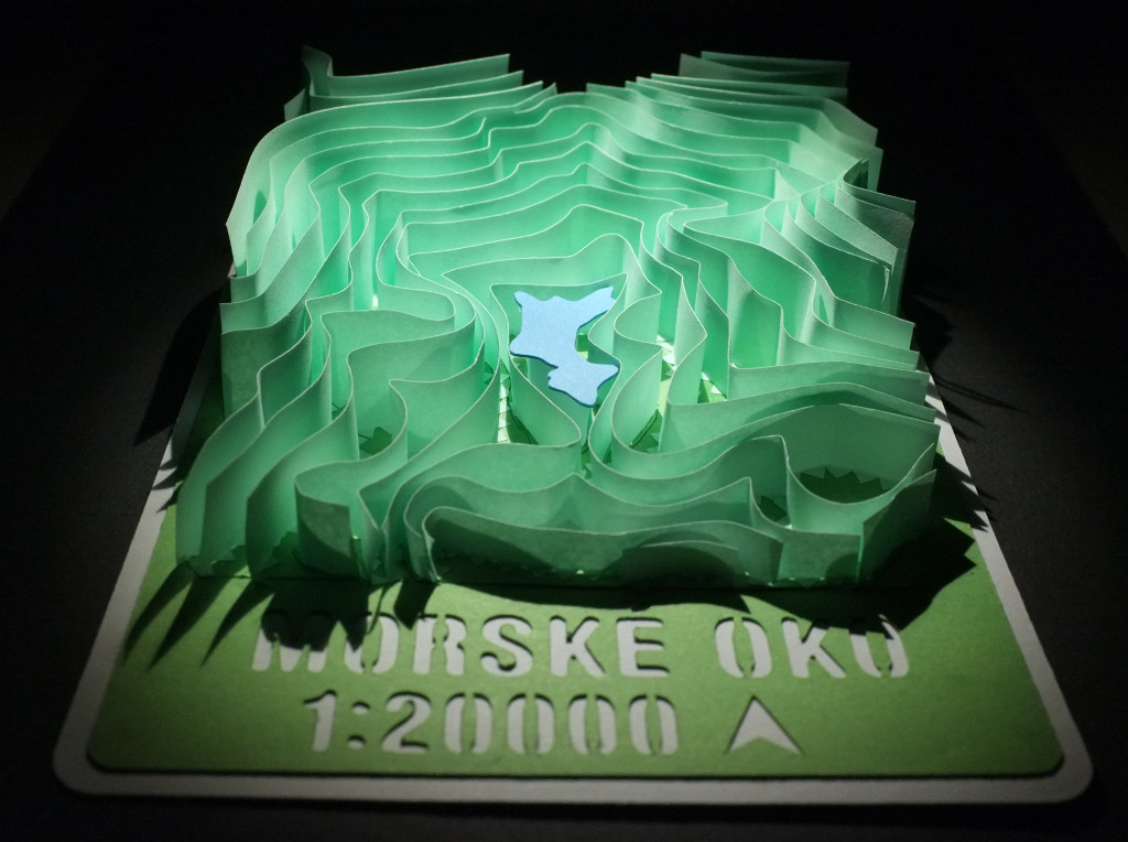
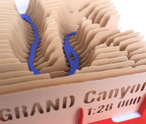
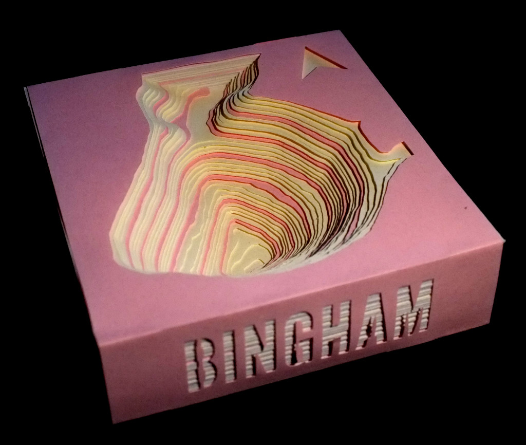
Paper models of terrain/landscape. Mapquest Elevation API is used to gather the elevation isolines and the paper layers are cut on a blade cutter machine.
Source: Peter's DIY Blog
Added by: Peter Vojtek.
Category:
Physical model
Tags:
cartographic, elevation landscape papercraft terrain paper cut