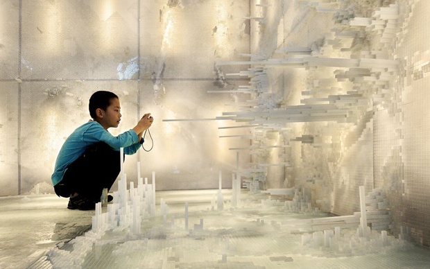
Two Yale architects created a room-sized physical visualization of world population density folded into itself:
Hsiang and Mendis then turned that spatial visualization into a physical installation at the 2011 Chengdu Biennale in China. They modeled the population distribution of the entire world in a kind of inverted map that visitors could walk into, inside a 10-by-10-by-10 foot room, with North America on the ceiling, Asia on one wall, Africa on another (see also the little boy in the above photo):
Sources:
- Emily Badger (2013). What If the Entire World Lived in 1 City?
- Via Rodrigo Derteano's pinterest
Added by: Pierre Dragicevic.
Category:
Passive physical visualization
Tags:
cartographic, data sculpture, population density, walkable
