Tag: globe

1934 – Hayward's Moon Model

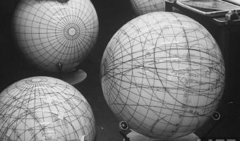
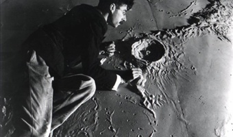
Illustrator and model-maker Roger Hayward (1899-1979) working on a model of the lunar surface for the Griffith Planetarium, 1934. Sources: Kevin Kidney (2009) Mr. Hayward's Moon Model. Photo from Keven Kidney's blog, textual description courtesy of Klaus Hentschel. For more, see Klaus Hentschel (2014): Visual Cultures in Science, Technology and Medicine, pp. 217-226.

Added by: Pierre Dragicevic, sent by: Klaus Hentschel. Category: Physical model  Tags: 
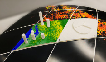
cartographic, globe, moon


1934 – Ford's Globe

A large rotating relief globe showing Ford company's industrial sites around the word, exhibited at the Chicago World's Fair in 1934. Sources: Willard Cope Brinton (1939) Graphic Presentation, p. 160. The Henry Ford Blog (2013) Ford at the Fair. More photos from the Henry Ford Online Collection.

Added by: Pierre Dragicevic. Category: Physical model  Tags: Brinton, cartographic, globe, walkable


1961 – Voskhod Spacecraft 'Globus' IMP navigation instrument

This device was the location indicator for Russian spacecrafts from the world's first manned spaceflight by Yuri Gagarin, 12 April 1961, until 2002. It contains a mechanical computer and a physical globe which rotated to always display the point on earth exactly underneath the spacecraft, or, alternatively, the point where the spacecraft would land if the re-entry rockets where fired at that exact moment. The numbered bullets on the globe in the third picture indicate radio communication […]

Added by: Yvonne Jansen. Category: Measuring instrument  Tags: globe, mechanical computer, navigation instrument


2014 – Blaue Blumen: Handcrafted Offline Data Visualization of Population Density

Physical visualization of the population density of the world. Handcrafted with toothpicks and a styrofoam ball. Based on data taken from this map. Source: Ewa Tuteja, (http://tuteja.info/blaueblumen/)

Added by: Krasser Terror. Category: Passive physical visualization  Tags: cartographic, data sculpture, globe, hand-made


2017 – Fabricating Physical Globe Visualizations

Geospatial datasets are too complex to easily visualize and understand on a computer screen. Combining digital fabrication with a discrete global grid system (DGGS) can produce physical models of the Earth for visualizing multiresolution geospatial datasets. This proposed approach includes a mechanism for attaching a set of 3D printed segments to produce a scalable model of the Earth. Two models have been produced that support the attachment of different datasets both in 2D and 3D format. Also […]

Added by: Hessam Djavaherpour. Category: Enabling technology  Tags: 3d printing, cartographic, digital fabrication, globe, rearrangeable