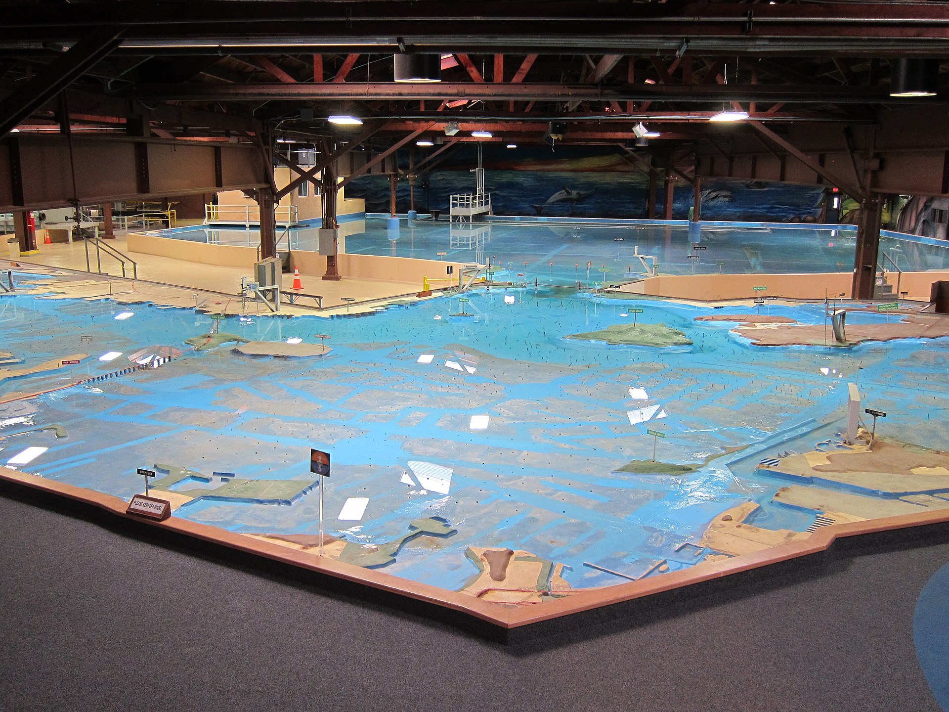
A working hydrodynamic model of San Francisco Bay and the surrounding waterways, with tides. It is still open to the public as a demonstration, although it is no longer used for research.
<em>Source:</em> Wikipedia <a href="https://en.wikipedia.org/wiki/U.S._Army_Corps_of_Engineers_Bay_Model">U.S. Army Corps of Engineers Bay Model</a>.
Related: Also see our related entry 1949 – Mississippi River Basin Model.
Added by: Ed Mooring.
Category:
Physical model
Tags:
cartographic, hydraulic, physical computation, terrain model, walkable, water