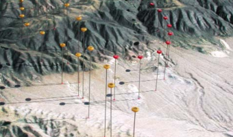
A real case study involving the use of a physical 3D trajectory visualization on top of a 3D terrain model to analyze the causes of a plane crash. This case study is interesting in terms of cost-benefit analysis, since these models appear to be extremely time-consuming to build. The case study includes an informal comparison with animations: "The mock jurors later related that the physical model was easier to understand and it allowed them to discuss the issues with each other more easily than […]
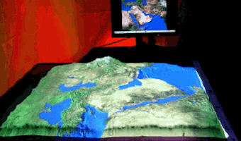
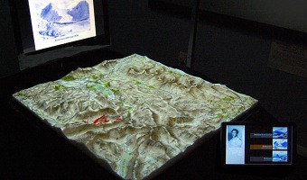
A real case study involving the use of a physical 3D trajectory visualization on top of a 3D terrain model to analyze the causes of a plane crash. This case study is interesting in terms of cost-benefit analysis, since these models appear to be extremely time-consuming to build. The case study includes an informal comparison with animations: "The mock jurors later related that the physical model was easier to understand and it allowed them to discuss the issues with each other more easily than the animation." The company who builds these models, STM, uses a milling machine and a 3D inkjet printer. Source: Terrain Modeling, Inc. (2013) Case Study: Aviation Accident Litigation (also see 2003 brochure).
Added by: Pierre Dragicevic.
Category:
Passive physical visualization
Tags:
cartographic, litigation, plane crash, solid terrain model