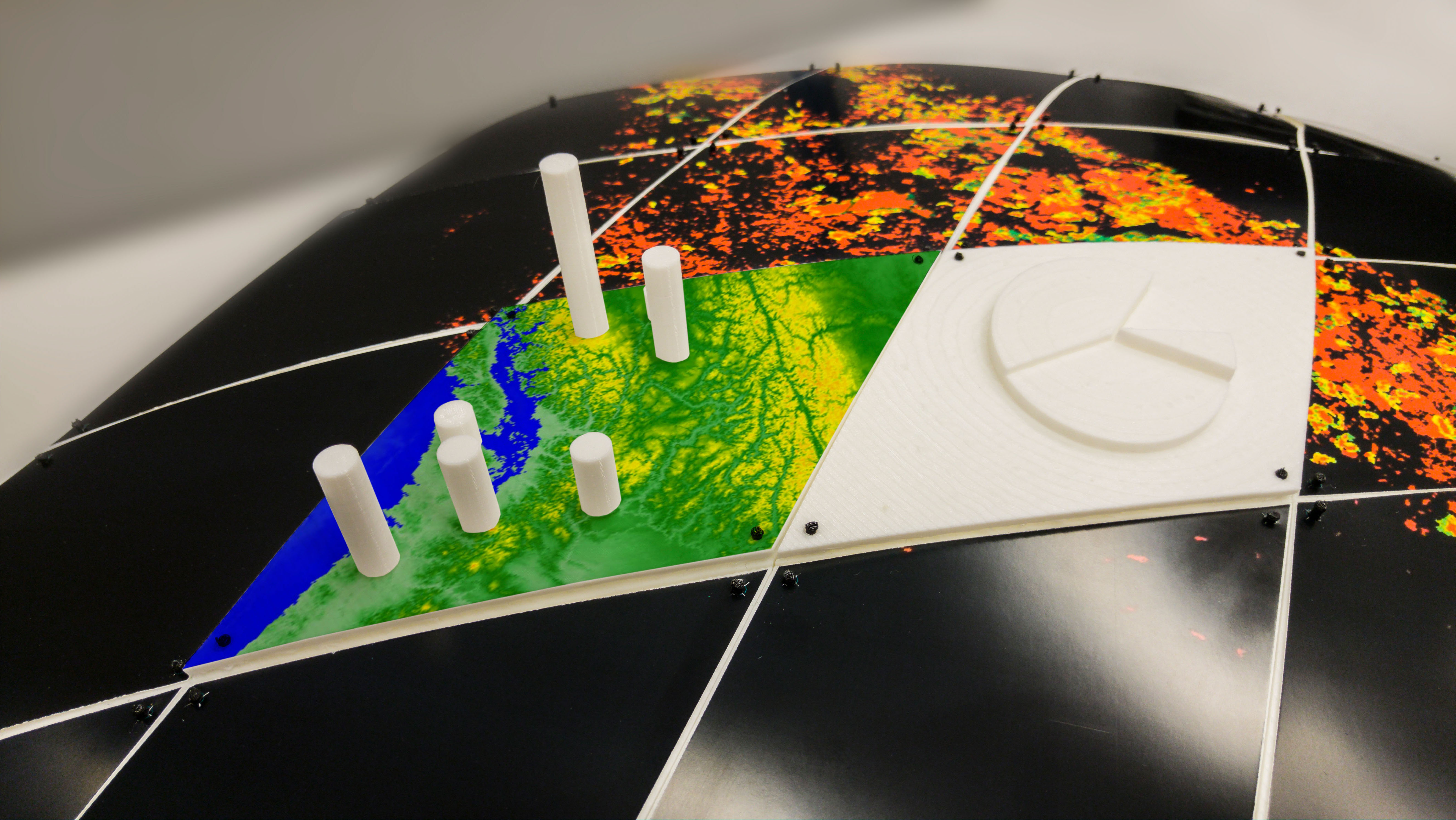
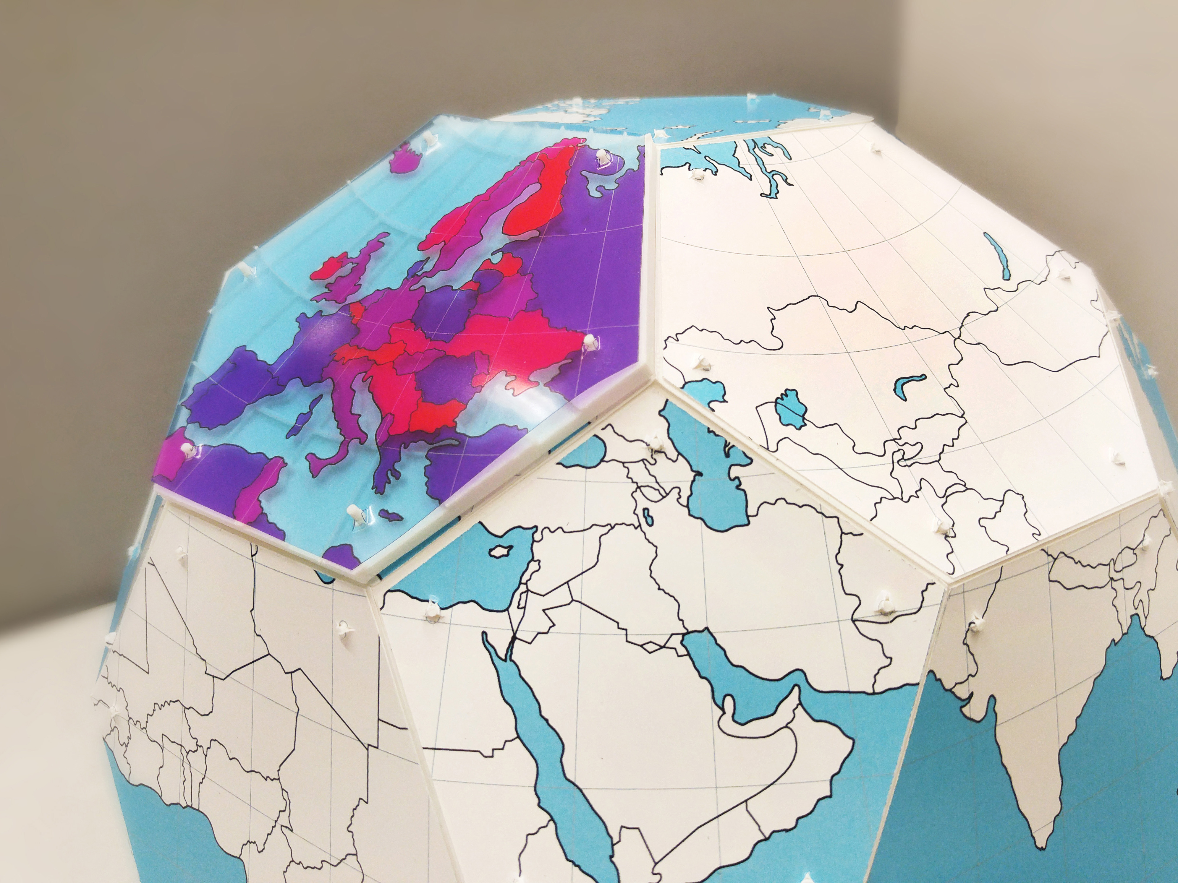
Geospatial datasets are too complex to easily visualize and understand on a computer screen. Combining digital fabrication with a discrete global grid system (DGGS) can produce physical models of the Earth for visualizing multiresolution geospatial datasets. This proposed approach includes a mechanism for attaching a set of 3D printed segments to produce a scalable model of the Earth. Two models have been produced that support the attachment of different datasets both in 2D and 3D format.
Also see our other entries on globe models and rearrangeable physical visualizations.
Source: Hessam Djavaherpour, Ali Mahdavi-Amiri, Faramarz F. Samavati (2017) Physical Visualization of Geospatial Datasets.
Added by: Hessam Djavaherpour.
Category:
Enabling technology
Tags:
3d printing, cartographic, digital fabrication, globe, rearrangeable